
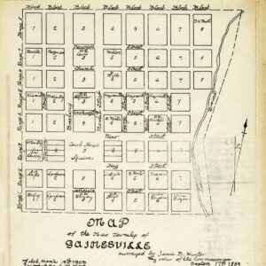
Surveying and mapping have a rich history dating back thousands of years. In ancient Egypt, surveyors used simple tools such as rope with knots to measure land boundaries and construct the pyramids. As early as the 1500s, Florida surveyors were utilizing primitive tools to map and navigate the region in the development of railroads and roads, which connected growing communities. Fast forward to modern times, surveying and mapping have evolved to become highly technical and sophisticated fields.
Today, surveying and mapping are critical for a wide range of applications, from property ownership and development to infrastructure planning and disaster preparedness. This article delves into the definition and significance of these fields, the various types of surveys, and their relevance in the A/E/C industry. Additionally, we’ll discuss essential factors to consider when selecting a surveying and mapping provider, as well as the future of the industry as technology advances.
WHAT IS SURVEYING AND MAPPING?
Surveying is the science, art, and profession of determining the positions of points on the surface of the earth and measuring the distances, directions, angles, and elevations between them. This can involve using a variety of tools and techniques, such as GPS (Global Positioning System), aerial photography, and ground-based measurements using instruments like total stations and levels. Mapping is the process of creating a visual representation of the data gathered during surveying, which can take many forms, from simple two-dimensional plans to complex three-dimensional models and geographic information systems (GIS) that integrate multiple layers of data.
Surveying and mapping form a critical foundation for many fields, including civil engineering, construction, urban planning, environmental science, and more. Accurate surveying and mapping can help ensure the safe and efficient use of land, resources, and infrastructure, as well as support informed decision-making in a wide range of applications.
What is a Surveyor and Mapper?
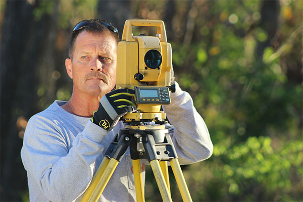
A surveyor and mapper is a skilled professional who specializes in measuring and mapping the features of land, water, and air to determine its boundaries, elevations, and topography, which are material to the development of any project.
Surveyors and mappers perform the following roles and responsibilities:
- Establish property boundaries and create maps and survey plots of the site
- Measure and record physical characteristics of the land, including elevation, distance, and direction
- Conduct research and analyze existing survey data, maps, deeds, and other relevant documents
- Provide expert advice to clients on land use, zoning, and building regulations
- Prepare legal documents such as land deeds, maps, and boundary descriptions
- Serve as expert witnesses in court cases and provide expertise to engineers, architects, and developers
Becoming a Licensed Professional Surveyor and Mapper (PLS / PSM)
To become a licensed land surveying professional, individuals must meet education and experience requirements and pass an examination. The requirements for licensure may vary by state, but typically include:
- A bachelor’s degree in surveying and mapping or a related field such as geomatics or land surveying.
- Four to six years of experience as a subordinate to a licensed surveyor.
- Successful completion of the Fundamentals of Surveying (FS) exam, the Principles and Practice of Surveying (PS) exam, and a state-specific examination.
- Learn more about becoming a Licensed Professional Surveyor and Mapper (PLS / PSM) in Florida
Land surveyors can work in a variety of industries, including the A/E/C industry, government agencies, and private firms:
- In the A/E/C industry, these professionals are typically involved in the planning, design, and construction of buildings, roads, bridges, and other important infrastructure projects. They play a critical role in ensuring that these projects are built according to plan and within regulatory requirements.
- In government agencies, land surveyors may work for departments responsible for land management, zoning, and environmental protection.
- Private firms may hire land surveyors to provide services such as boundary surveys, topographic surveys, and construction layout services.
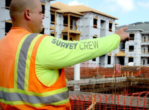
The planning and execution of nearly every successful infrastructure project begins with the daily work of professional surveyors and mappers, survey field crew, and CADD technicians. The wide range of career possibilities requires a high level of technical expertise and a strong understanding of surveying and mapping principles.
What is a land survey?
A land survey is a report, drawing, or map of a parcel or parcels of land, which provides precise measurements on the shape, size, and boundaries of the property and location of any structures or features found on the property.
Land surveys can also provide information on the topography and natural features of the land, such as trees, bodies of water, and slopes, which can be important for environmental assessments and planning. They can also be used to identify any potential hazards or risks, such as flooding or landslides, and inform decisions about land use and development.
Importance of Land Surveys
Land surveys are essential in establishing legal descriptions and providing legal proof of property ownership ensuring property owners are aware of their boundaries and rights. Here are a few of their main benefits:
- Legal Proof of Property Ownership: Land surveys are the only legally binding documents that define where a property begins and ends. Having a recent survey on file is crucial when purchasing or selling property and helps to prevent legal disputes.
- Property Disputes: Land surveys help to resolve disputes between neighbors and ensure that construction projects comply with zoning and building regulations.
- Building and Development: Land surveys are necessary before any new construction, renovation, or expansion project. They help to identify any potential issues with the site and ensure compliance with zoning regulations and building codes.
Land surveying and mapping are vital to the success of the A/E/C industry, providing critical data for land development, infrastructure planning, property ownership, and legal disputes. Understanding the various types of surveys is essential in selecting the most suitable survey for a specific project and ensuring accurate and reliable data collection.
WHAT ARE THE DIFFERENT TYPES OF SURVEYS?
Surveying and mapping are essential tools for a wide range of industries which rely on accurate measurements and mapping of land and structures to ensure the successful completion of their projects. In this section, we’ll explore the different types of surveys that are commonly used in the A/E/C industry.
ALTA/NSPS Land Title Surveys:
An ALTA/NSPS land title survey is a comprehensive survey that meets the standards set by the American Land Title Association (ALTA) and the National Society of Professional Surveyors (NSPS). It provides a detailed report of a property’s boundary lines, improvements, easements, rights-of-way, encroachments, and other features that could affect ownership or the use of the property. ALTA/NSPS surveys are usually required for commercial properties and provide a comprehensive view of a property’s physical and legal characteristics, helping identify potential issues or conflicts that could arise in the future.
Commercial/Residential Boundary Surveys:
A commercial/residential boundary survey accurately identifies the boundaries of a property, including its corners, lines, and angles. These surveys are essential for resolving property disputes, complying with zoning regulations and building codes, and providing evidence of legal property ownership.
Construction Layout Services:
Construction layout services, also known as construction staking or site layout survey, establish and mark the precise location of proposed structures, utilities, and other infrastructure on a construction site. This crucial step ensures buildings are placed correctly according to design plans and minimizes errors and conflicts, reducing the risk of costly rework later in the construction process.
Lot Splits + Boundary Line Adjustments:
Lot splits and boundary line adjustments are processes related to the division of land into separate parcels or lots. A lot split involves dividing an existing piece of land into two or more separate lots or parcels, while a boundary line adjustment involves changing the boundaries of existing lots or parcels to better fit the needs of the property owner. These complex processes require the services of a licensed surveyor to ensure the new lots or parcels are accurately defined and comply with the local zoning and subdivision regulations for approval from the local planning department or zoning board.
Platting Services and Lot Staking:
Platting services involve mapping and staking an entire property to define the boundaries and dimensions of the property, as well as any legal restrictions. During lot staking, land surveyors place survey monuments or markers at property corners and lines, at predefined intervals, using wooden stakes to clearly mark property boundaries. This type of surveying is used to ensure that the land is properly prepared for development.
Topographic Surveys:

A topographic survey is used to gather detailed data about the location of natural and man-made features of the land. These features include elevations, contours, trees, streams, drainage ditches, grading, buildings, and more. A topographic survey is a useful tool for landscape architects and engineers for land planning and development, site design, engineering design, and environmental analysis.
As-Built or Record Drawings:
As-built surveys are important for documenting the final horizontal and vertical field location of constructed improvements, such as sewer pipes, buildings, and utilities, in relation to the engineered construction plans, design changes, and contractor’s field changes. These surveys ensure that construction projects are completed according to plan and serve as a record of the final, “as-built” state of the building or structure. Often required by regulatory agencies, these land surveys are useful for property management, maintenance and repair, and future construction or renovation projects.
Wetland + Environmental Surveys:
Wetland and environmental surveys are assessments conducted to identify and evaluate the natural features and resources of a particular area, including wetlands, habitats, and other environmental features. These surveys are used to determine the presence and extent of wetlands, wildlife habitats, endangered species, and other environmentally sensitive areas. The goal of wetland and environmental surveys is to ensure that development projects and other activities do not negatively impact the environment and to identify potential mitigation measures to minimize any impacts. These surveys may be required by local, state, or federal regulations and are typically conducted by environmental consultants or specialists.
Hydrographic + Mean High Water Surveys:
Hydrographic and Mean High Water (MHW) surveys are specialized surveys that measure and map the depths, contours, and features of bodies of water, such as lakes, rivers, and coastal areas. Hydrographic surveys are typically used for navigation, dredging, and engineering purposes, while MHW surveys are used to establish the legal boundary between public and private land along the shoreline. These surveys are conducted using specialized equipment, such as sonar, GPS, and multibeam echosounders, to create accurate maps and 3D models of the water and land features. These surveys are specifically important for peninsulas, such as Florida.
FEMA Elevation Certificates:
FEMA Elevation Certificates verify property’s location, flood zone designation, and the structure’s elevation. The certificate is often required by lenders and insurance companies for properties located in flood zones to determine flood insurance rates, building code compliance, and other flood-related issues. Licensed land surveyors or engineers typically prepare these certificates in compliance with the National Flood Insurance Program.
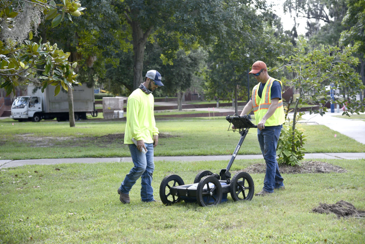
Subsurface Utility Locations:
Subsurface utility locations involve identifying and mapping the location of underground utilities, such as water pipes, gas lines, electrical cables, and telecommunication lines, using methods such as ground-penetrating radar, electromagnetic induction, or vacuum excavation. The Subsurface Utility Engineering process helps prevent accidental damage during construction or excavation work, enables utilities to be relocated or repaired more efficiently, and prevents service interruptions by identifying potential issues before they occur.
What is Subsurface Utility Engineering?
Aerial Surveying and Mapping:
Aerial surveying and mapping is a method of collecting geospatial data from the air using various sensors mounted on a survey aircraft or drone. This technique is used to create highly accurate maps, 3D models, and other geospatial data products useful for large-scale mapping projects such as city planning and infrastructure development.
Surveying and Mapping provides critical information about the characteristics of a site, including its boundaries, topography, and existing infrastructure enabling A/E/C professionals to plan and execute projects with a high degree of accuracy, reducing the risk of costly errors, safety hazards, and project delays. In the next section, we will delve deeper into the benefits of surveying and mapping and explore some of the specific ways these tools are used to support successful project outcomes.
THE IMPORTANCE OF SURVEYING AND MAPPING IN THE A/E/C INDUSTRY
The architecture, engineering, and construction (A/E/C) industry is a highly collaborative field that encompasses a wide range of professions involved in the planning, design, construction, and maintenance of buildings, infrastructure, and other structures. From landscape architects and engineers to ecologists and project managers, each profession plays a vital role in ensuring that projects are completed safely, on time, and within budget. This industry encompasses a variety of projects, including residential and commercial buildings, infrastructure, and energy systems, and is an essential part of the economy, providing employment opportunities and contributing to the growth and development of strong communities.
Importance of Surveying and Mapping in A/E/C Projects
Surveying and mapping play a crucial role in providing accurate and reliable data that is essential for project planning and execution. The following are some of the ways surveying and mapping contribute to the success of A/E/C projects:
Planning and Design: Surveying and mapping provide accurate and reliable data that landscape architects, engineers, and construction professionals use in planning and designing a project. This includes topographic data, elevation data, boundary lines, and legal descriptions of the property. The information is critical for creating the initial design of a project and for determining the feasibility of a proposed project.
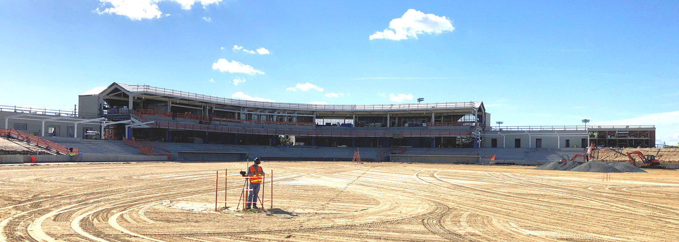
Construction: During the construction phase, surveying and mapping are used to ensure that the construction work is following the design plans accurately. Surveyors use precision instruments to locate and mark the position of construction elements such as buildings, roads, bridges, and utility lines. This helps to ensure that the construction work is carried out to the exact specifications of the design plans, minimizing the risk of errors and rework.
Site Evaluation: Surveying and mapping are critical in evaluating the suitability of a site for construction. This includes determining the topography, soil type, drainage patterns, and other factors that can affect the construction process. By evaluating these factors, architects and engineers can design structures that are both safe and environmentally sustainable.
Land Use Planning: Surveying and mapping provide information that is essential in land-use planning. This includes identifying zoning regulations, environmental constraints, and other factors that can affect land development. This information is critical for developing comprehensive land-use plans that balance economic, social, and environmental considerations.
Property Ownership: Surveying and mapping are used to determine the boundaries of a property and the legal description of the land. This information is essential in property transactions, including buying and selling, leasing, and easement agreements. Surveyors also provide accurate data on the location and size of improvements, such as buildings, roads, and utilities, which can impact property value and development potential.
Accurate Site Planning: Surveying and mapping provide accurate measurements of the land, including its topography, boundaries, and other features that may affect the design and construction of a project. This information is essential for site planning, ensuring that the project is built on a stable foundation and that it meets all zoning and regulatory requirements. Accurate site planning is crucial for ensuring the long-term success of a project and minimizing the risk of future problems or failures.
Building and Development Compliance: Surveying and mapping also play a critical role in ensuring that buildings and structures are built in compliance with local building codes and regulations. Surveyors provide precise measurements and data to ensure that buildings are constructed within the specified boundaries and that they meet all regulatory requirements. This helps to ensure the safety and structural integrity of buildings and structures.
Infrastructure and Utility Planning: Surveying and mapping also contribute to the planning and construction of infrastructure and utility systems, such as roads, bridges, and pipelines. Surveyors provide accurate data on the land and the surrounding environment, including its topography, soil conditions, and other factors that may affect the design and construction of these systems. This information is critical for designing infrastructure and utility systems that are both safe and environmentally sustainable.
The Power of Surveying and Mapping: Success Stories in A/E/C Projects
You can find examples of A/E/C projects that have utilized surveying and mapping to ensure their success across the globe. These Florida examples demonstrate the importance of surveying and mapping in a wide range of projects, from large-scale infrastructure projects to iconic landmarks. By providing accurate and reliable data, surveying and mapping help ensure the success of these projects, both in terms of safety and efficiency.

The University of Florida (UF) is committed to creating a sustainable and well-designed campus that integrates with the existing character of the 2,000+ acre campus. To achieve this, UF has undertaken several campus master planning initiatives, including the use of 3D scanning and modeling technologies to create accurate digital representations of existing buildings, infrastructure, and green spaces. The UF Data Science and Information Technology Building (DSIT) is a testament to the success of this planning approach. The building’s design incorporated surveying and mapping, which enabled the project team to control construction costs by identifying potential conflicts early in the process. With detailed survey information, including utility locations and full 3D models, the project team could accurately visualize proposed developments, assess the impact on the campus environment, and avoid potential conflicts with existing or planned improvements. This comprehensive planning approach has resulted in a more sustainable and well-designed campus that meets the needs of students, faculty, and the surrounding community.
In Florida, surveying and mapping play a significant role in the state’s environmental conservation efforts. Wetland and environmental surveys are essential for ensuring that development projects comply with state and federal regulations for the protection of natural resources. In comparison to other states, Florida has unique environmental features, such as its extensive coastline and the Everglades, making these projects more complex than similar projects in other states.
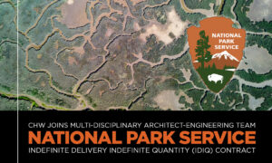
The Everglades Restoration Project aims to restore and preserve this unique ecosystem, with surveying and mapping playing crucial roles in tracking environmental changes and guiding restoration efforts. In 2022, CHW joined the Multi-Disciplinary Architect-Engineering (A-E) Team led by Walker Architects for the Indefinite Delivery Indefinite Quantity (IDIQ) Contract with the National Park Service. Uniting in the care of U.S national parks in Southeast Region, which includes the states, possessions, and territories of Louisiana, Mississippi, Alabama, Georgia, Florida, Tennessee, Kentucky, South Carolina, North Carolina, Puerto Rico, and the Virgin Islands (primary geographic area).
KEY CONSIDERATIONS FOR CHOOSING A SURVEYING AND MAPPING PROVIDER
Understanding the role of surveying and mapping is essential for anyone working in industries that rely on accurate spatial data. Whether you are a property owner looking to establish legal proof of ownership, a developer planning new construction projects, or an engineer designing infrastructure systems, surveying and mapping data is essential for making informed decisions. With the right surveying and mapping provider, you can ensure that your projects are based on accurate data and meet all relevant regulations and standards.
Factors to Consider When Choosing a Surveying and Mapping Provider
Experience and Reputation: Consider the provider’s experience and reputation in the industry. Look for a provider that has a good track record and extensive experience in surveying and mapping in the specific area or type of project you are working on. Check their references and online reviews to get an idea of their reputation.
Communication and Collaboration: Consider the provider’s communication and collaboration skills. A good provider should be able to provide clear communication about the project timeline, keep you informed about any issues or delays, and actively collaborate with you and stakeholders to ensure project goals are met.
Range of Services: Consider the range of services the provider offers. Some providers specialize in specific types of surveying and mapping services, while others offer a full range of services. It may be more efficient and cost-effective to choose a provider that offers a full range of services, as it can reduce the need for multiple providers.
Technology and Equipment: Check what technology and equipment the provider uses. A provider that uses the latest technology and equipment will likely be more efficient, accurate, and cost-effective. Ask the provider what equipment and technology they will use for your project and how it will benefit the project.
Quality Assurance: Ensure that the provider has a quality assurance program in place to ensure the accuracy and quality of their work. Ask the provider about their quality assurance program, including the procedures they follow and the measures they take to ensure accuracy and quality.
Certifications and Licenses: Ensure that the provider has all the necessary certifications and licenses required by the state or local jurisdiction where the project is taking place. This will ensure that the provider meets the legal requirements and has the necessary knowledge and skills to perform the work.

Importance of Choosing the Right Provider
Cost and Time Savings: When looking for a provider, it’s important to keep in mind the potential for cost and time savings. By choosing an experienced provider equipped with the latest technology, you can ensure that your project is completed efficiently and accurately, ultimately reducing the need for costly revisions or delays.
Accurate and Reliable Results: The accuracy and reliability of your surveying and mapping results are crucial to the success of your project. Therefore, it’s important to choose a provider with the necessary experience, equipment, and communication skills to ensure that your results are accurate and reliable. When you choose the right provider, you can feel confident that your project is in good hands.
Expert Guidance and Advice: An experienced provider with knowledge of the industry and a comprehensive understanding of local and federal regulations can help you avoid potential legal issues, delays, and non-compliance issues that could otherwise significantly impact your project’s timeline and budget.
By keeping these key considerations in mind, you can choose a provider that can meet your project’s needs and ensure its success.
THE FUTURE OF SURVEYING AND MAPPING IN THE A/E/C INDUSTRY
The A/E/C industry is continually evolving and adopting new technologies that are improving the accuracy and speed of surveying and mapping services. These technologies have led to the development of new techniques, which offer better data quality, quicker turnaround times, and increased accuracy. In this section, we will explore the emerging trends in surveying and mapping and their potential impact on the A/E/C industry.
Emerging Trends in Surveying and Mapping
Emerging trends in surveying and mapping are shaping the future of the industry, leading to improved efficiency, accuracy, and safety. Here are some of the most notable trends:
Drones and Aerial Surveying
Drones are becoming increasingly popular in the A/E/C industry, particularly for large-scale projects. Aerial surveying with drones provides high-resolution images, which can be used to create 3D models of terrain and structures. This technology can significantly reduce the time and costs associated with traditional land surveying techniques.
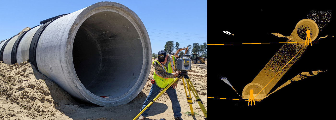
3D Laser Scanning and 3D Model Creation
3D laser scanning is a technique that uses lasers to capture high-resolution, 3D images of objects and structures. This technology is particularly useful in capturing data on existing structures, and the 3D models created from the scan can be used to identify potential design problems or compatibility issues.
GIS and Mapping Software
Geographic Information System (GIS) technology is used to store, analyze, and manipulate geographic data. GIS mapping software is becoming increasingly popular in the A/E/C industry as it allows for improved data visualization and analysis, making it easier for designers and engineers to plan projects accurately.
These technological advances in the A/E/C industry have resulted in:
- Improved Efficiency and Accuracy: The integration of new technologies in surveying and mapping has improved the accuracy and efficiency of data collection and analysis. This technology has led to more reliable data and has allowed for faster project turnaround times.
- Enhanced Visualization and Communication: The 3D models created using laser scanning, drone mapping, and GIS technology can be used to improve project visualization and communication. This visualization can aid stakeholders in better understanding project designs and identifying potential design issues before construction.
- Opportunities and Challenges in the Future of Surveying and Mapping: The future of surveying and mapping is exciting, with emerging technologies providing significant opportunities for the A/E/C industry. However, the integration of these technologies also presents several challenges, such as increased costs and the need for specialized knowledge and skills.
By adopting new technologies, surveying and mapping professionals can streamline their workflows, provide more accurate data, and communicate more effectively with clients and stakeholders.

CONCLUSION
In conclusion, surveying and mapping play a vital role in the success of projects across various industries. As technology continues to evolve, they will become even more efficient and accurate, providing enhanced visualization and communication opportunities for the A/E/C industry.
At CHW Professional Consultants, we are committed to delivering multi-disciplinary high-quality solutions that create effective, long-term partnerships with our clients. Our team of over 100 employees across Florida has a wide range of expertise in civil engineering, surveying and mapping, land development planning, ecological services, landscape architecture, urban design, transportation planning and traffic engineering, and construction engineering inspection services.
When it comes to surveying and mapping, choosing the right provider is critical to ensuring accuracy, reliability, and cost-effectiveness. At CHW, we take pride in supporting our clients’ goals and our commitment to communication and collaboration ensures that our clients’ needs are always met. If you’re looking for a provider that delivers a diverse portfolio of professional services, look no further than CHW.
Published March 15, 2020; Updated March 28, 2023